THE CONTINENTAL ARMY MOVEMENTS FROM BRANDYWINE TO VALLEY FORGE: TRAPPE TO FATLANDS AND ON TO CAMP POTTSGROVE
Part 1
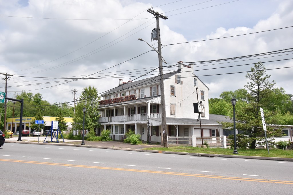
After moving through Trappe and down the hill to the Perkiomen Creek – in present-day Collegeville, the army crossed to the east side of the creek. The Perkiomen Bridge Hotel stands in disrepair at the bridge over the creek. Built around 1706 (I’ve also seen 1701), it was there when the army passed through, although I’ve been unable to find any reference to it related to the Philadelphia Campaign (although I didn’t look too hard). A permanent bridge of the Perkiomen was not built until 1799 and prior to that, the creek was crossed at Phillips Ford or over small, wooden bridges which did not survive. The army camped for the rest of the night at the Perkiomen. Exactly where is unknown, however in John Marshall’s “The Life of George Washington” he states that they camped on both sides of the creek until continuing towards the Schuylkill on the 20th of May.


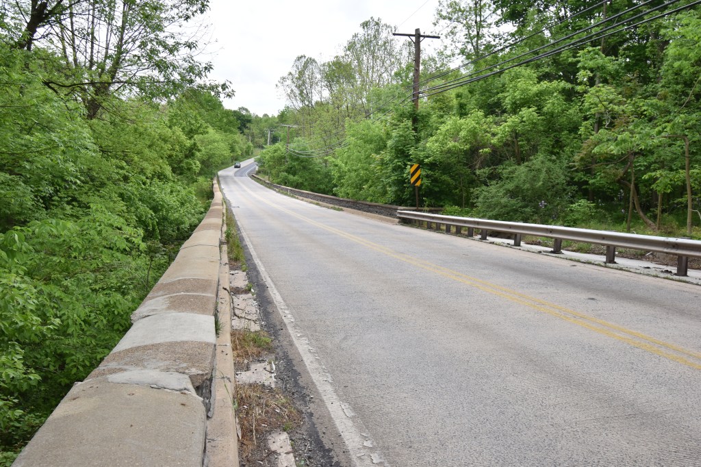
At 4:00 AM the army broke camp and headed down the Great Road, through Evansburg, “and crossed the Skippack, and thence to Pauling’s Ford, in Providence Township, where we encamped. We had a fair view of the enemy’s encampment, being only separated from us by the Schuylkill and a small hill.” (William P. McMichael. “Diary of Lieutenant James McMichael, of the Pennsylvania Line, 1776–1778.” Pennsylvania Magazine of History and Biography 16 (1892)). Although the exact route is unknown, although at least for McMichael’s unit, they probably went as far as Eagleville and then turned right and proceeded down Eagleville Road through Audubon to Pawling’s Ford. Thomas McGuire writes they took up “positions along the left bank of the Schuylkill on a nine-mile wide front from Gordon’s Ford to Swede’s Ford hoping to shield both Reading and Philadelphia.” (McGuire, “The Philadelphia Campaign – Volume One, Page 306. Gordon’s Ford is at present-day Phoenixville and Swede’s Ford is between Norristown and Bridgeport. Both armies were face-to-face and could see each other’s movements from across the Schuylkill. Unlike today, the area was probably denuded of trees in many areas, making it difficult to mask troop movements.

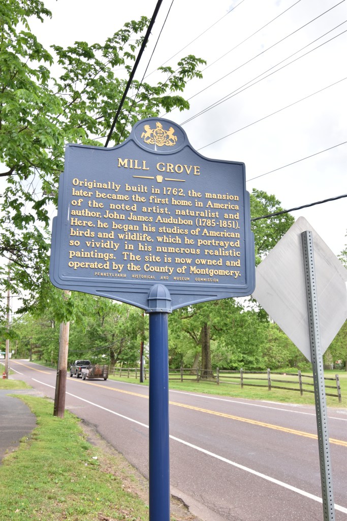
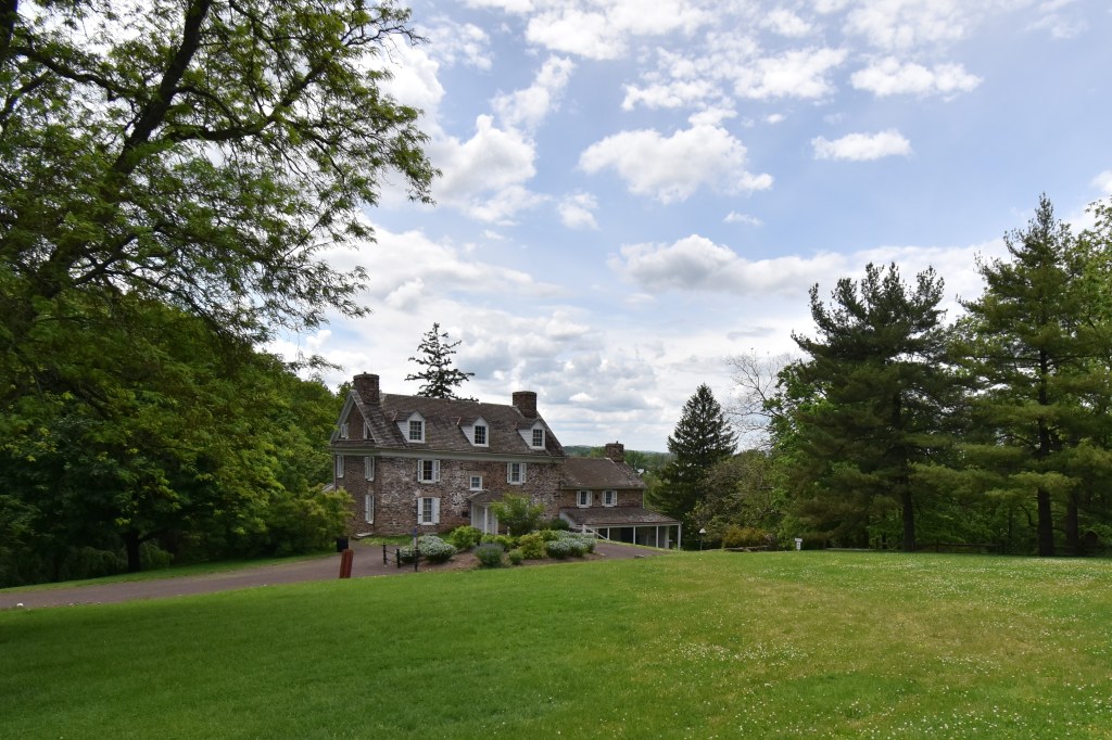
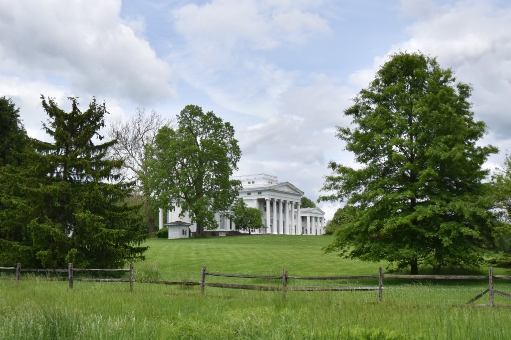
Washington continued further along the Great Road (present day Ridge Pike) and setup his headquarters at Thompson’s Tavern at the intersection of Egypt Road and Ridge Pike, in the center of his line. This tavern was also known as the Jeffersonville Inn, and is no longer standing, torn down in 1939. Not far from Washington’s Headquarters, down Egypt Road on the other side of Audubon were two large farms, Mill Grove Farm and Fatland Farm. James Vaux purchased the Fatland Farm in 1772 and renamed it Vaux Hill, and it overlooked the Fatland Ford crossing the Schuylkill at Valley Forge. The original farmhouse was torn down in the 19th century and a Greek Revival style mansion was built in 1845. Both the original farmhouse at Mill Grove and the Vaux Hill mansion are pictured here.
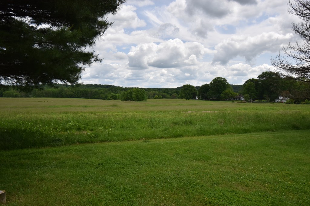
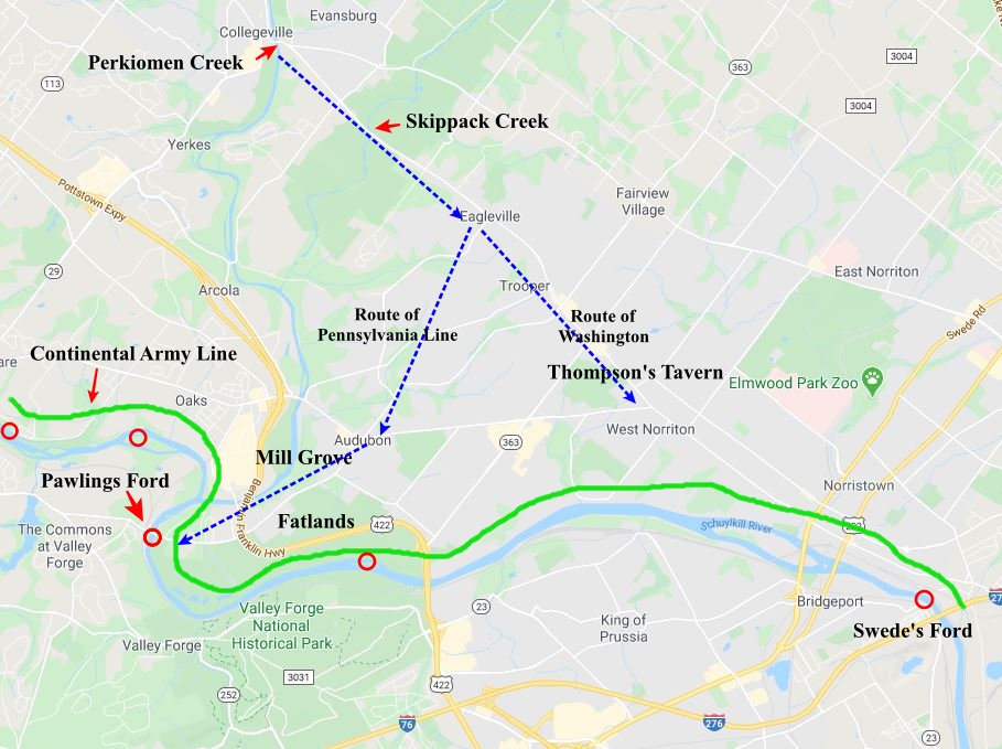
The Continental Army was spread out over both farms, from the Pawling’s Ford shortly to the West, and then along the river through present-day Norristown.
Also, Rich DeLeo on Facebook provided this photo of the historical marker in Valley Forge NP where Sullivan’s Bridge was located. This is close to the location of Fatlands Ford. The marker is on the East side of the river and can be accessed from the River Trail either from the Pawling’s Ford NPS parking area or the Betzwood NPS parking area.
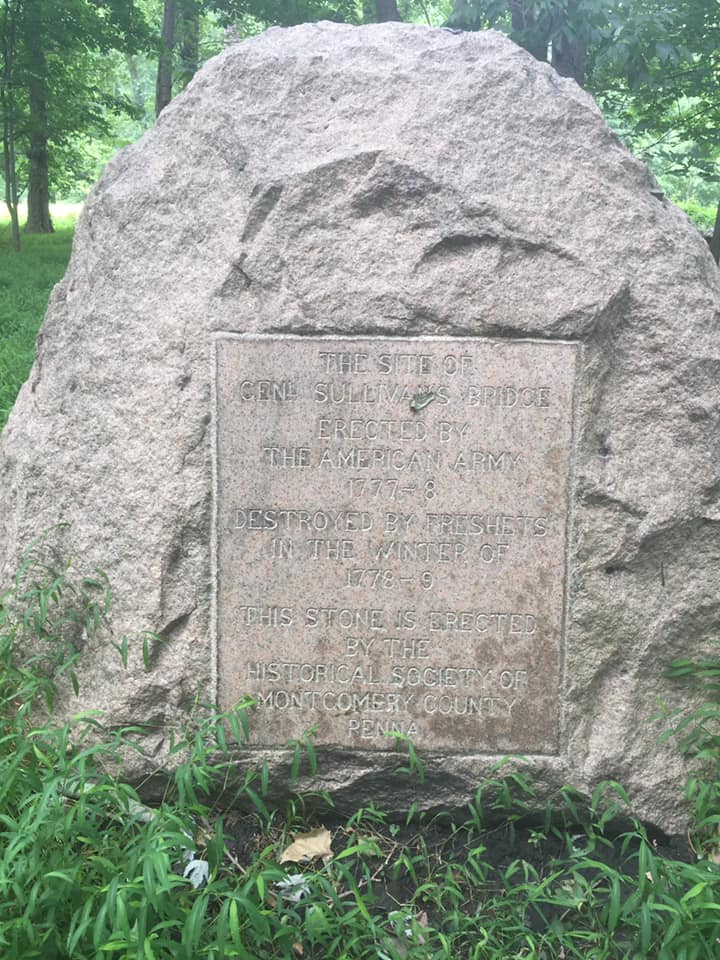
General Sullivan built a bridge across the Schuylkill River in Feb., 1778 to provide an escape route for the Continental Army camped at Valley Forge, and to also bring provisions over from the other side of the river.
