On my post yesterday, Dorothy Pennachio mentioned Buford’s Massacre, also known as the Battle of Waxhaws, so I’m posting pics from that site. I visited here in January on the Cowpen’s Anniversary weekend. Tomorrow I’ll post Ninety-Six, then Eutaw Springs, followed by some miscellaneous pics. I may throw in Cowpens and Kings Mountain.
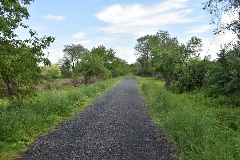
The Buford’s Massacre site is located at 262 Rocky River Rd, Lancaster, SC 29720, which is Rt. 522, just below Burford, SC – a little over five miles from the NC/SC state line. The town of Waxhaw is located in NC, just over the border, however the entire area both in NC & SC was known as Waxhaw at the time of the AmRev. Waxhaw is named after Siouan-language, Native American group that inhabited the region up until about 1720.
Colonel Abraham Buford commanded a force of Virginia Continentals who were dispatched to help defend Charleston; however upon learning of it’s capture, turned back towards VA. Cornwallis learned that South Carolina Governor John Rutledge was travelling with Buford after escaping Charleston, and he assigned Banister Tarleton to pursue and capture Rutledge. Tarleton caught up to Buford, and Buford stopped to engage the British here at the battle site.
Tarleton attacked with three detachments, leading the left flank himself and the British quickly crushed the Patriot lines. There is some debate as to what and why happened next, however the British proceeded to massacre the surrendering Continentals.
Not disputed is the reaction of the Patriots and Tarleton’s reputation as a brutal and barbaric enemy. “Tarleton’s Quarter!” meaning take-no-prisoners became a Patriot rallying cry. Word of the massacre influenced many neutral SC and back country settlers to join the Patriot cause.
Please also see descriptions/comments on the photos.
All of the great comments and discussions on my posts have inspired me to continue posting (although not every day) after I’m done with what I have on the Southern Campaign. I have some pics from some Philadelphia Campaign sites, and once I get back to PA, will have some new, less well known AmRev content. Hopefully you’ll continue to find them interesting.
Ninety Six is a fascinating (and underappreciated) site. There is so much going on here historically, it rouses my internal Social Studies teacher: Native American studies and colonial relations, frontier colonial life, colonial and frontier politics, Westward expansion, military fort and siege tactics/military engineering and of course, the Southern Campaign.
No lack of great Patriot leaders as well including Greene, Pickens, Harry Lee, Thaddeus Kosciuszko (personal favorite) and to a lesser extent Sumter and Lee (who were moving to reinforce Greene and prevent Rowden who was moving from Camden to relieve the loyalists under siege).
The Ninety Six National Historical Site is located at Ninety Six, SC, 1103 Highway 248 S, Ninety Six, SC 29666. The visitor’s center is small but decent, and the site features colonial life exhibits relating to the frontier town that was there; a reproduction stockade fort from the 1781 battle that was built over the original, simple fort from the 1775 battle between loyalists and patriots; and the star fort with siege trenches and fortifications.
I’m posting more pics than usual since as I mentioned, there’s a lot going on here. Please see the comments/descriptions on the photos that go into more detail. I’ve included some of the interpretive panels on display to give you a better idea of what you’re looking at. It will take me a little time to update all the descriptions on the photos, so check back.
The Battle of Eutaw Springs was on Sept. 8th, 1781 and was the last major battle of the Revolutionary War in the Carolinas. The battlefield is located at 12933 Old Number Six Hwy, Eutawville, SC 29048, just South of the town. I believe the site is owned by the American Battlefield Trust.
Cornwallis was now in Virginia. Greene had moved from Ninety Six, through Camden (Battle of Hobkirk’s Hill) and now was looking to defeat the remaining 2,500 British troops left in the Charleston area. The British leader, Colonel Alexander Stewart, led his forces out to counter the advancing Continentals. The battle commenced about two miles West on Monck’s Corner Road (the direction viewed in picture C) when Greene’s forces came across a British foraging party. The British fell back to their camp (the current location of the battle site pictured here) with the Patriots in pursuit.
Greene arranged his forces across the road pictured in C and advanced towards the camp. After several charges and counters, the British fell back to a brick house (no longer standing) where they re-formed lines. It was reported that the American troops paused to loot the British camp and this provided the opportunity for the British to counter-attack.
The Americans fell back from the British counterattack, and at the end of a very bloody day, the British controlled the battlefield. Although a tactical British victory, like many others, the British withdrew and the battle here broke any possibility of the British going on the offensive again in the Carolinas.
Stewart fell back to Charleston and British forces remained there until Dec. 14th, 1782, well after Cornwallis’ surrender at Yorktown.
Some of the pictures are marked with a letter in the upper LH corner that correspond to the letters on the map also pictured here to give you an idea of the direction you’re viewing. Note that the creek on the historical maps is now the man-made Lake Marion which covers some of the area on the American left-flank.
The 239 Anniversary Celebration of the Battle of Cowpens happened on January 18th & 19th of this year. There’s been a fair amount posted over the last couple of months about Cowpens so I’m going to post less about the details of the battle and more pictures of the re-enactors and the grounds of the park.
Cowpens is located near Cowpens, South Carolina, about thirteen miles North of Spartanburg, SC. It’s a great battlefield to visit, the story of the battle is exciting, the leaders on both sides are remarkable (and notorious) and it’s very easy to explore the entire battleground. It’s appearance is very much like it was on January 17th, 1781. The American victory at Cowpens struck a severe blow to the British in the South, and was a large step on the path to the eventual surrender by Cornwallis at Yorktown.
If you’re visiting Cowpens from the North or East, it’s convenient to stop at King’s Mountain first, and then move onto Cowpens. After Cowpens, there are a lot of AmRev sites to visit South and West of Spartanburg, and then ultimately your tour should hit Ninety Six.
All of the pictures of the re-enactors are posted without their permission, so if you’re in one of the photos or know someone that is, and want it removed, please just let me know and I’ll do so.
One additional comment: I have great respect and admire the American Revolution re-enactors. They take history to a whole new level and bring it to life for many. Their devotion, time and the cost spent participating in these events is remarkable.
THE CONTINENTAL ARMY MOVEMENTS FROM BRANDYWINE TO VALLEY FORGE: TRAPPE TO FATLANDS AND ON TO CAMP POTTSGROVE
Part 1
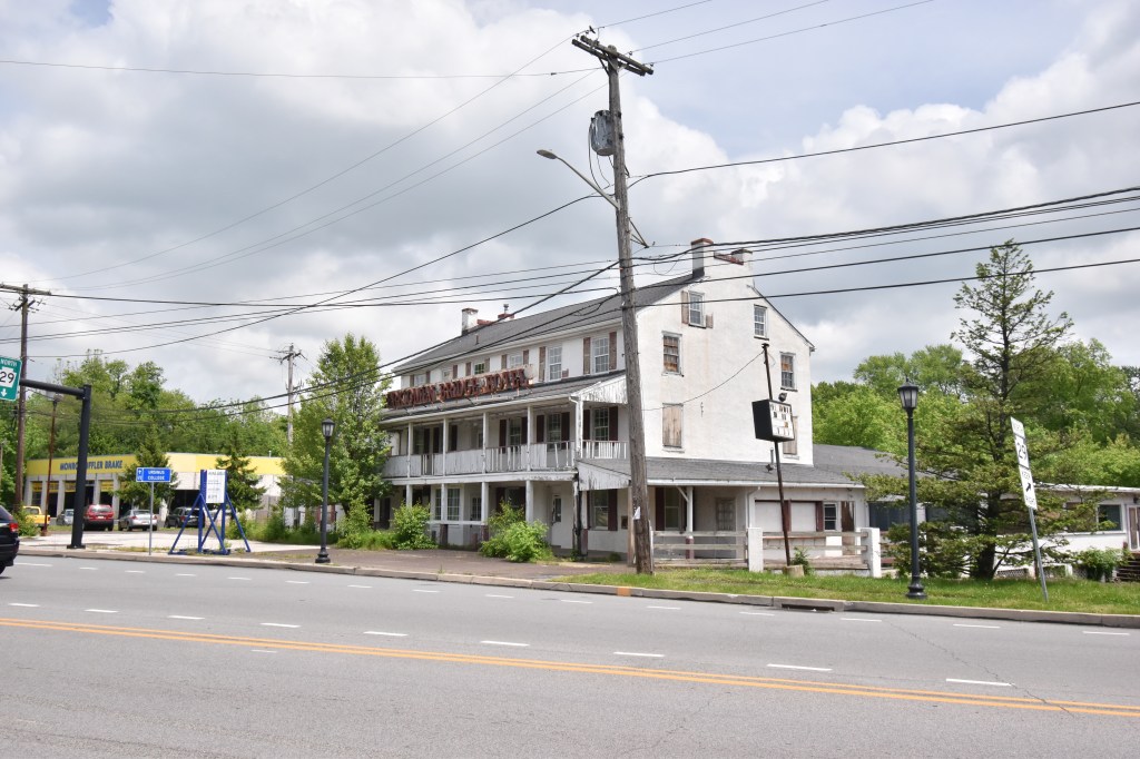
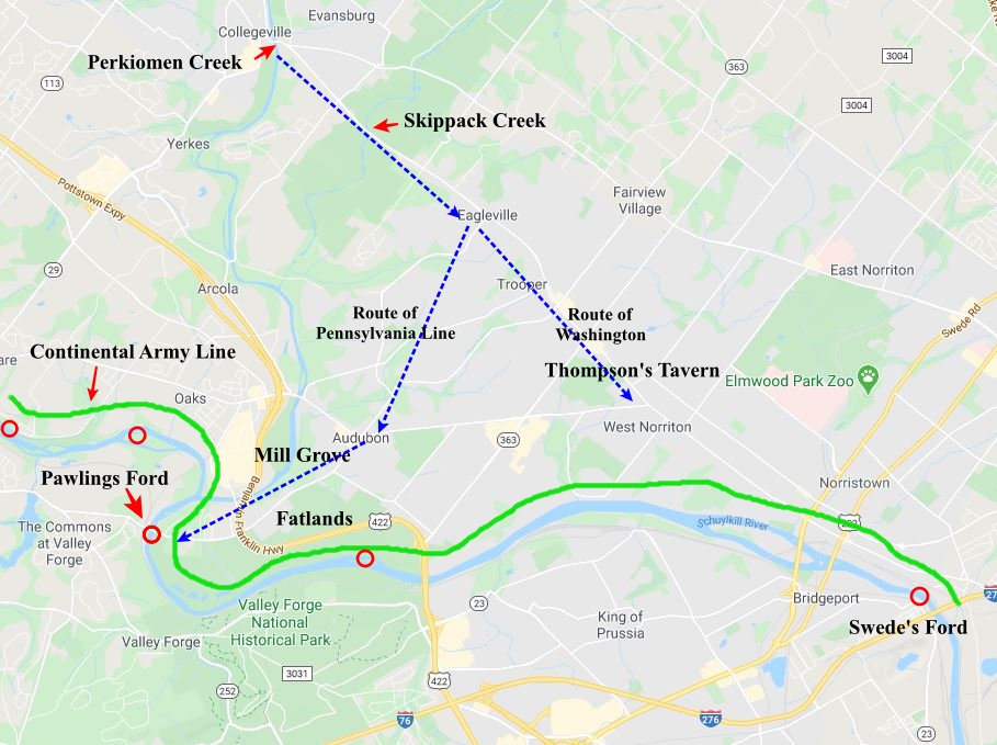
After moving through Trappe and down the hill to the Perkiomen Creek – in present-day Collegeville, the army crossed to the east side of the creek. The Perkiomen Bridge Hotel stands in disrepair at the bridge over the creek. Built around 1706 (I’ve also seen 1701), it was there when the army passed through, although I’ve been unable to find any reference to it related to the Philadelphia Campaign (although I didn’t look too hard). A permanent bridge of the Perkiomen was not built until 1799 and prior to that, the creek was crossed at Phillips Ford or over small, wooden bridges which did not survive. The army camped for the rest of the night at the Perkiomen. Exactly where is unknown, however in John Marshall’s “The Life of George Washington” he states that they camped on both sides of the creek until continuing towards the Schuylkill on the 20th of May.
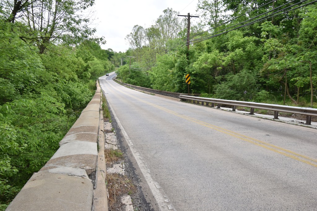
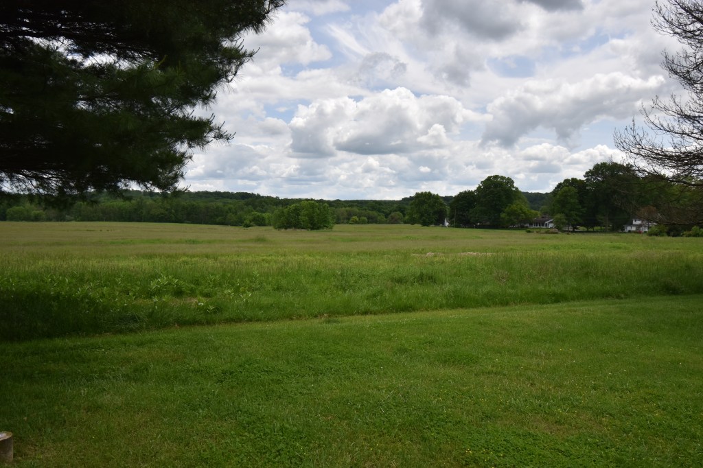
At 4:00 AM the army broke camp and headed down the Great Road, through Evansburg, “and crossed the Skippack, and thence to Pauling’s Ford, in Providence Township, where we encamped. We had a fair view of the enemy’s encampment, being only separated from us by the Schuylkill and a small hill.” (William P. McMichael. “Diary of Lieutenant James McMichael, of the Pennsylvania Line, 1776–1778.” Pennsylvania Magazine of History and Biography 16 (1892)). Although the exact route is unknown, although at least for McMichael’s unit, they probably went as far as Eagleville and then turned right and proceeded down Eagleville Road through Audubon to Pawling’s Ford. Thomas McGuire writes they took up “positions along the left bank of the Schuylkill on a nine-mile wide front from Gordon’s Ford to Swede’s Ford hoping to shield both Reading and Philadelphia.” (McGuire, “The Philadelphia Campaign – Volume One, Page 306. Gordon’s Ford is at present-day Phoenixville and Swede’s Ford is between Norristown and Bridgeport. Both armies were face-to-face and could see each other’s movements from across the Schuylkill. Unlike today, the area was probably denuded of trees in many areas, making it difficult to mask troop movements.
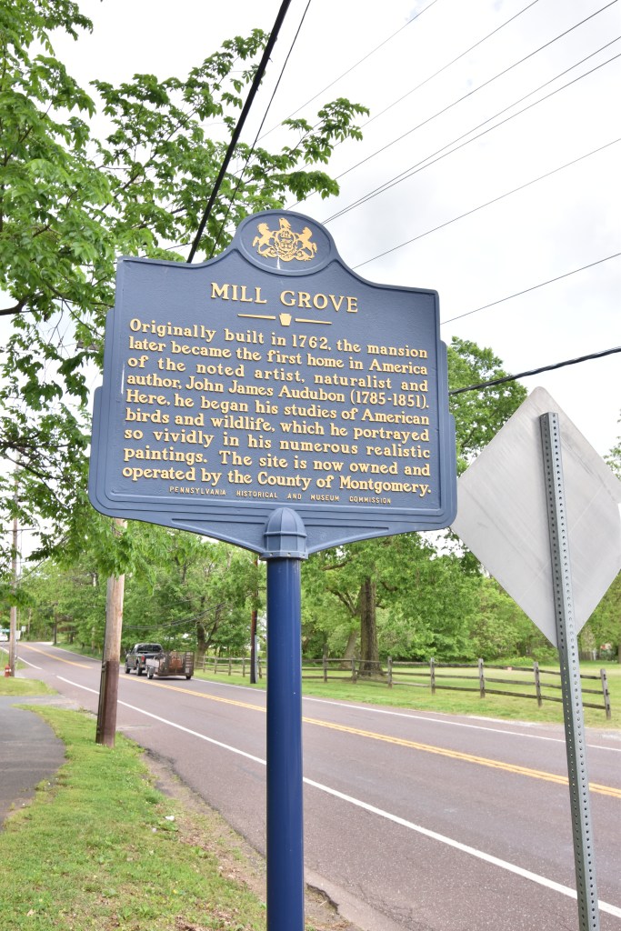
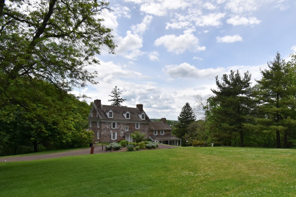
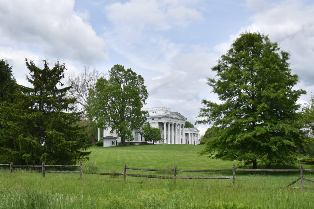
Washington continued further along the Great Road (present day Ridge Pike) and setup his headquarters at Thompson’s Tavern at the intersection of Egypt Road and Ridge Pike, in the center of his line. This tavern was also known as the Jeffersonville Inn, and is no longer standing, torn down in 1939. Not far from Washington’s Headquarters, down Egypt Road on the other side of Audubon were two large farms, Mill Grove Farm and Fatland Farm. James Vaux purchased the Fatland Farm in 1772 and renamed it Vaux Hill, and it overlooked the Fatland Ford crossing the Schuylkill at Valley Forge. The original farmhouse was torn down in the 19th century and a Greek Revival style mansion was built in 1845. Both the original farmhouse at Mill Grove and the Vaux Hill mansion are pictured here.
The Continental Army was spread out over both farms, from the Pawling’s Ford shortly to the West, and then along the river through present-day Norristown.
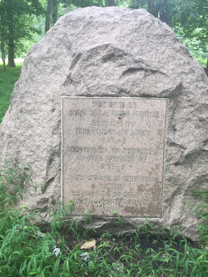
Also, Rich DeLeo on Facebook provided this photo of the historical marker in Valley Forge NP where Sullivan’s Bridge was located. This is close to the location of Fatlands Ford. The marker is on the East side of the river and can be accessed from the River Trail either from the Pawling’s Ford NPS parking area or the Betzwood NPS parking area.
General Sullivan built a bridge across the Schuylkill River in Feb., 1778 to provide an escape route for the Continental Army camped at Valley Forge, and to also bring provisions over from the other side of the river.
Once across the Schuylkill River, the Continental Army proceeded up what is now Linfield-Trappe Road towards Trappe and ultimately the fords south of Parker’s Ford to prevent the British from crossing over to the east side and moving down to Philadelphia. Today we don’t think of Philadelphia proper (at the time of the war, what is now center city was the extent of the town) not being accessible from the west bank of the Schuylkill River, but the river was a major barrier and had to be forded or crossed by boat. So these fords were key to both the British and the American strategies during the campaign. The Fatland Ford was a short distance from Valley Forge and the British encampment there – as you drive along Rt. 422 between Audubon and Oaks, you can see the current Fatlands Mansion up on the hill (which is down Pawlings Rd. from St. Gabriel’s Home, this is not the original house on this location)
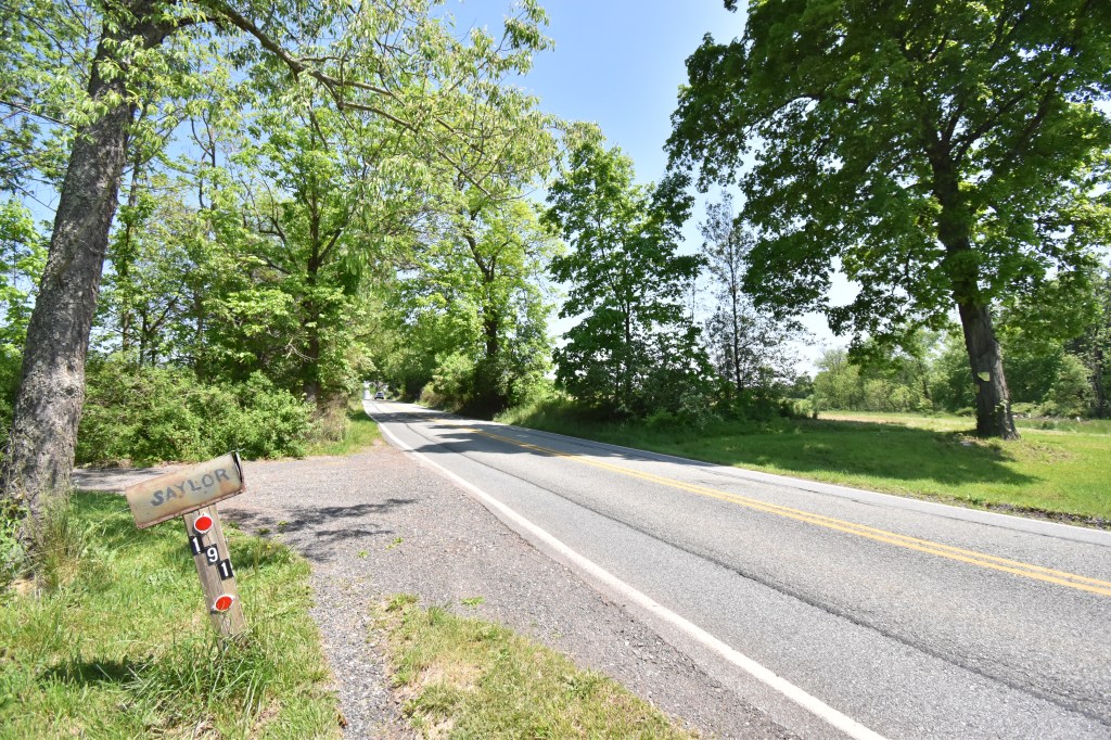
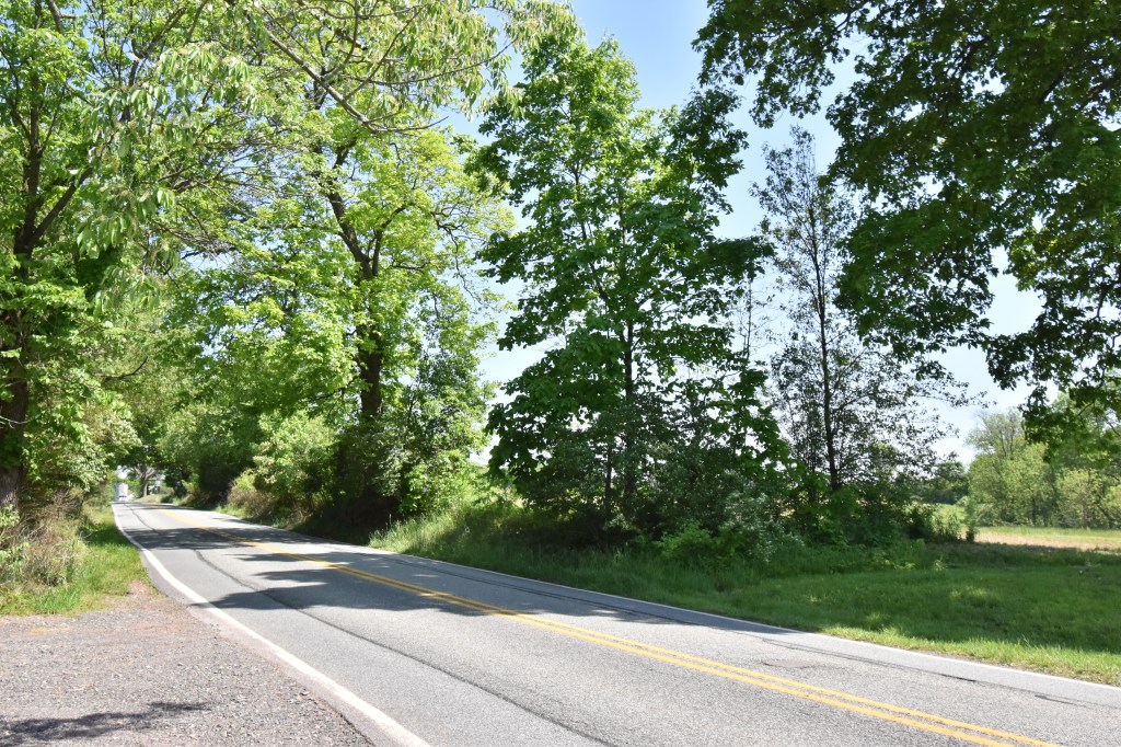
In the book “Limerick Township: A Journey Through Time 1699 – 1987”, Muriel Lichtenwalner relates a story where as the army marched along, they stopped to rest under an oak tree by the side of the road on the property of Limerick resident, Henry Saylor. Saylor came out of his house and spoke to Washington. There’s no record of what was said, but as of 1987, the oak tree was still there. The Saylor family still owns the property, and I couldn’t find the oak tree, so it probably came down within the past thirty-three years. (see pictures). There were a number of homes along this road and I’m sure may residents witnessed the passing of the army. One of the great things about this area is in looking at the Saylor pictures of today on Linfield-Trappe Road, besides the paved road, I bet this looked very similar to how it was in 1777 (less a few trees).
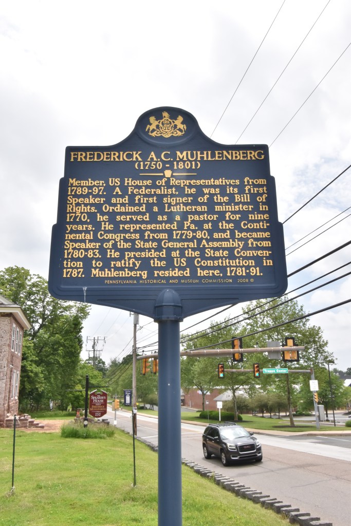
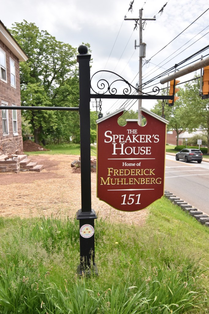
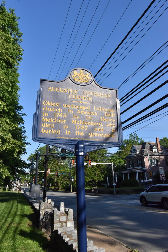
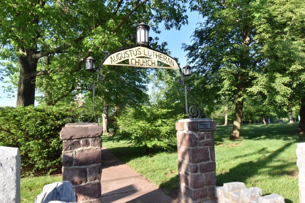
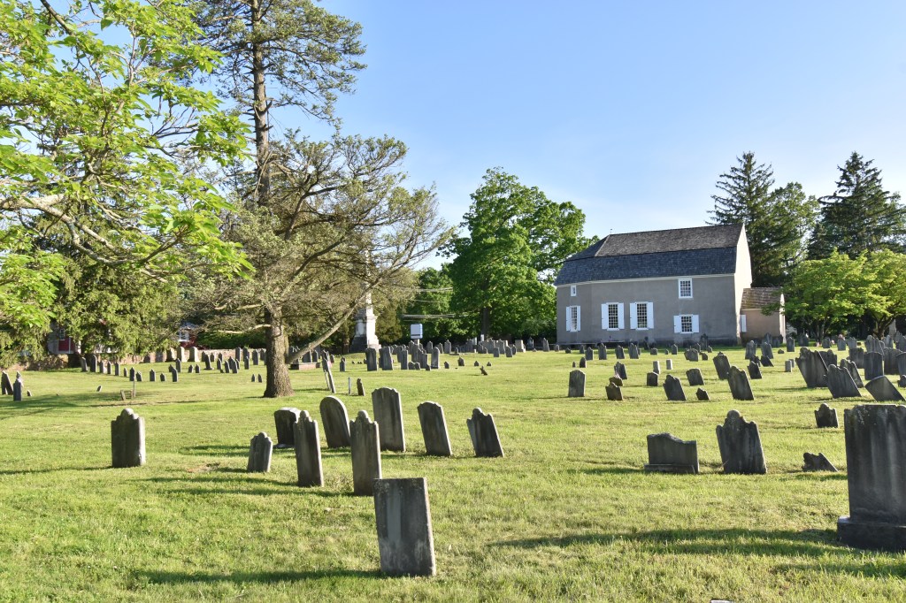
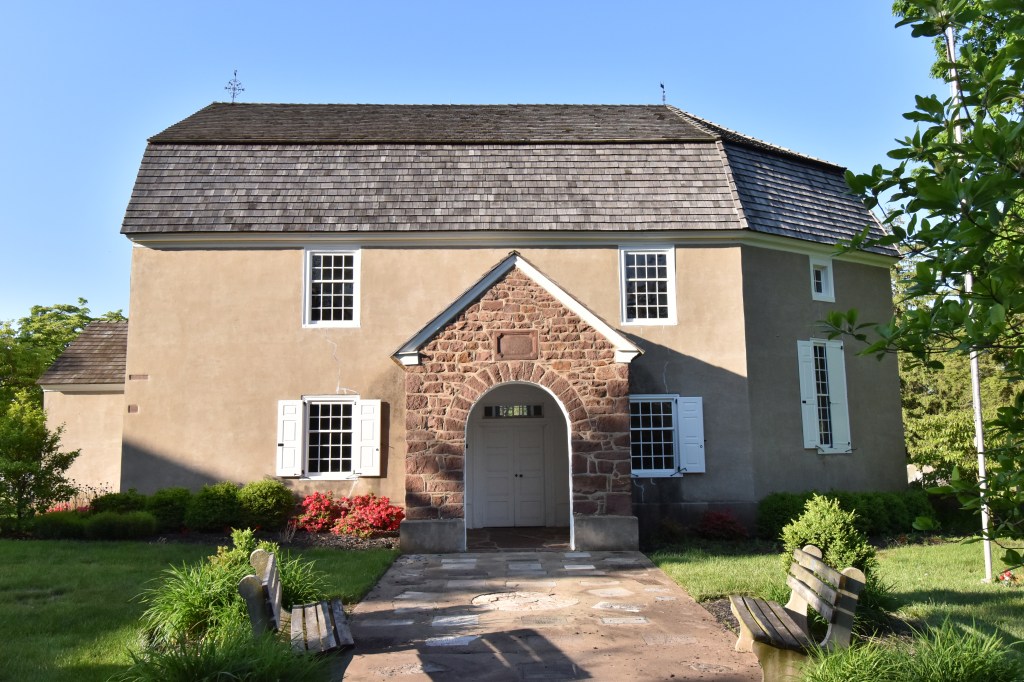
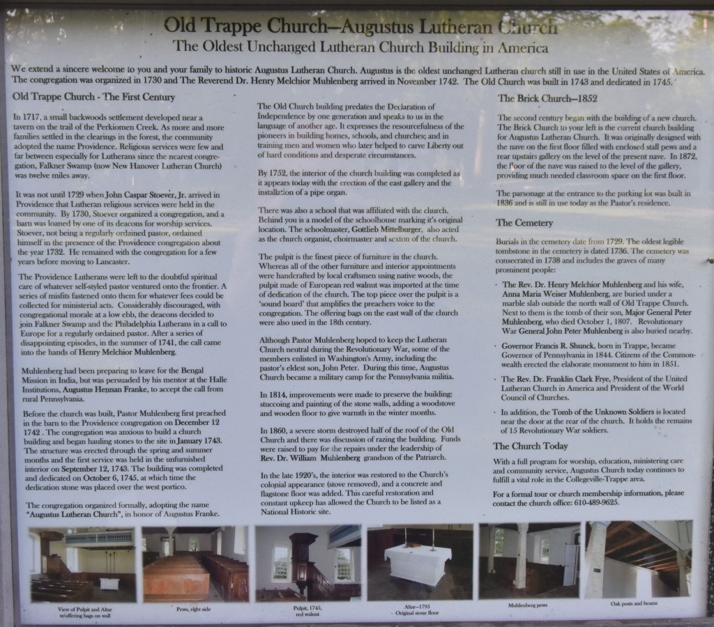
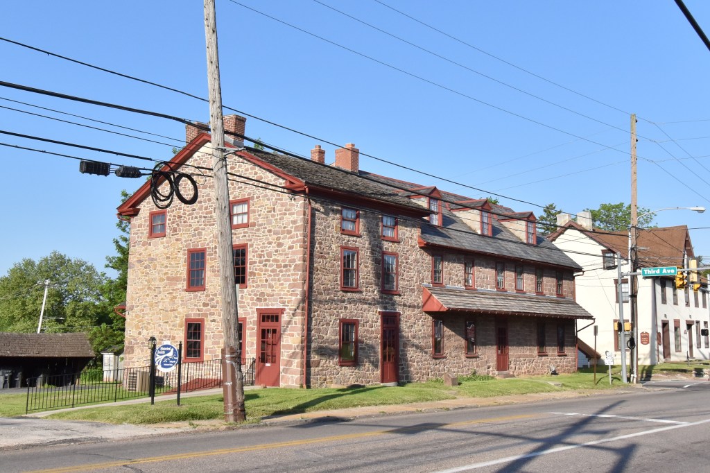
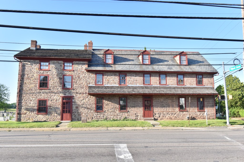
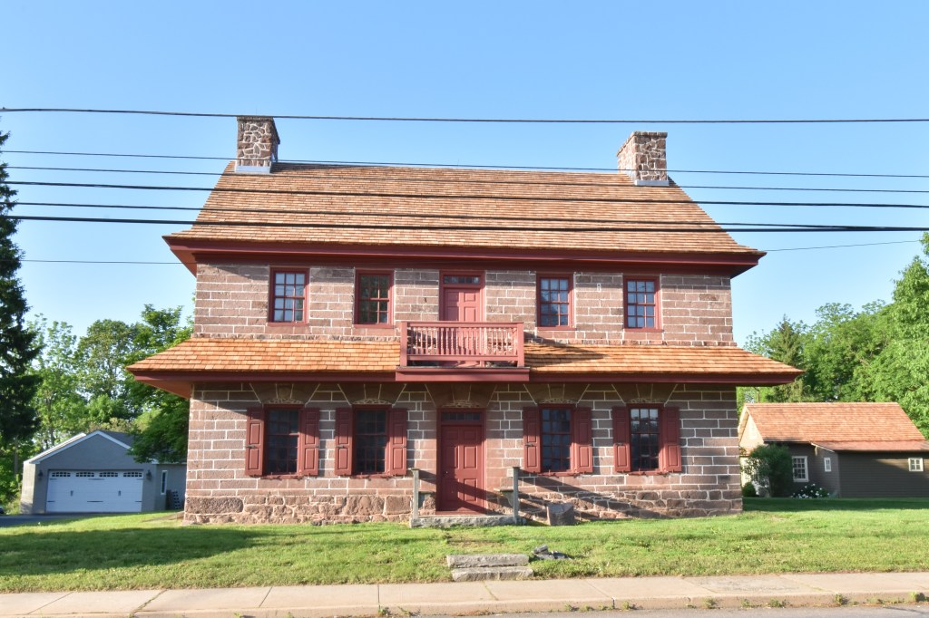
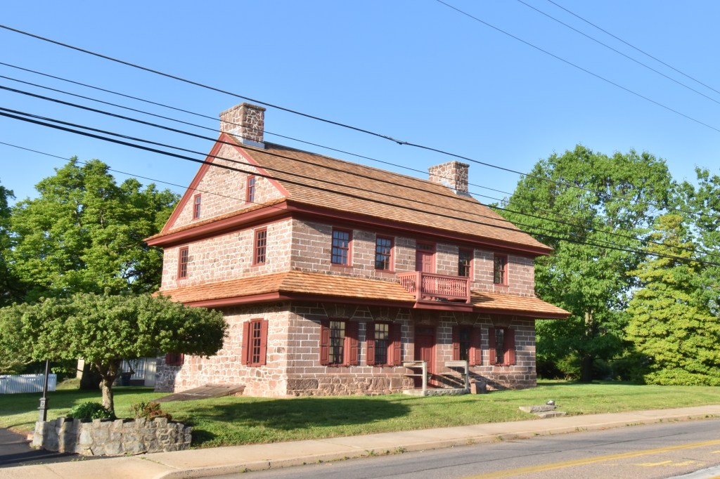
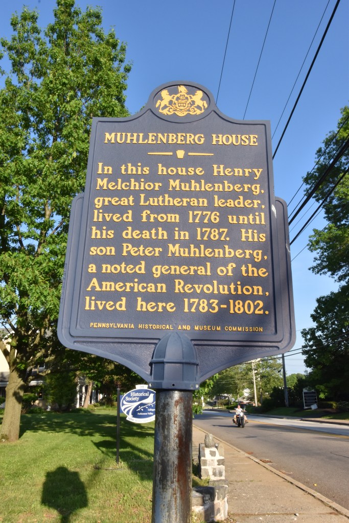
The army reached Trappe and onto the Great Road, passing by first the Augustus Lutheran Church and then farther along, the Dewees Tavern which was built around 1750 which served as a local meeting place besides tavern; and then the home of Henry Muhlenberg. Here is part of Muhlenberg’s diary entry that night which I posted in part 2: “The American troops then marched through the Schulkiel, four miles from us, and came out on the road to Philadelphia at Augustus Church [the Great Road I mentioned above]. They had to wade through the river up to their chests. His Excellency General W[ashington] was himself with the troops who marched past here to the Perkiome. The passage of the troops lasted through the night and we had all kinds of visitors, officers, etc. To get wet up to one’s chest and then to march in the cold, foggy night while enduring hunger and thirst, etc. is hard for the poor men. It takes courage, health, etc.” (Tappert and Doberstein, Muhlenberg Journals, 3:77–78).”
After passing through Trappe, the army proceeded through present-day Collegeville to the Perkiomen Creek. A permanent bridge of the Perkiomen wasn’t built until 1799 and prior to that, the creek was crossed at Phillips Ford or over small, wooden bridges which did not survive. They crossed the creek and camped on the far side.
I’ll revisit Trappe and Muhlenberg in future posts, as the Continental Army move back through the area several times until settling at Valley Forge.
Also, the Augustus Lutheran Church served as a hospital during the Philadelphia campaign and it’s cemetery has many colonial-era graves including Revolutionary War veterans and unknown soldiers. I’ll post more about this under my Philadelphia Campaign Hospitals and Burial Sites topic.
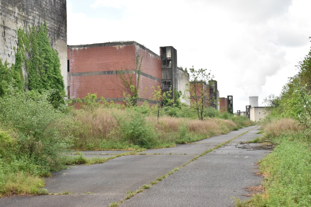
The east bank of Parker’s Ford is located in Linfield, Limerick Township and the Linfield-Trappe Road led from here to the Colonial Great Road (present day Ridge Pike) just west of Trappe. At the time the road was known as the Schuylkill Road. This was the intended route for the army to move down towards the lower fords on the Schuylkill. The ground on the Linfield rises up thirty feet or so from the banks of the river and the road proceeds eastward. The area now is the old, abandoned Linfield Industrial Park, home of the Kinsey Distillery (see photo for explanation). There was at least one home and outbuildings there at the time of the Revolution, but they are long gone and there’s no trace of the road from the ford to the existing Linfield-Trappe Road.
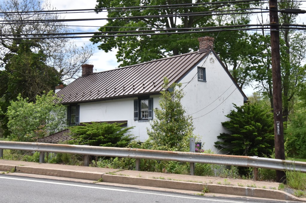
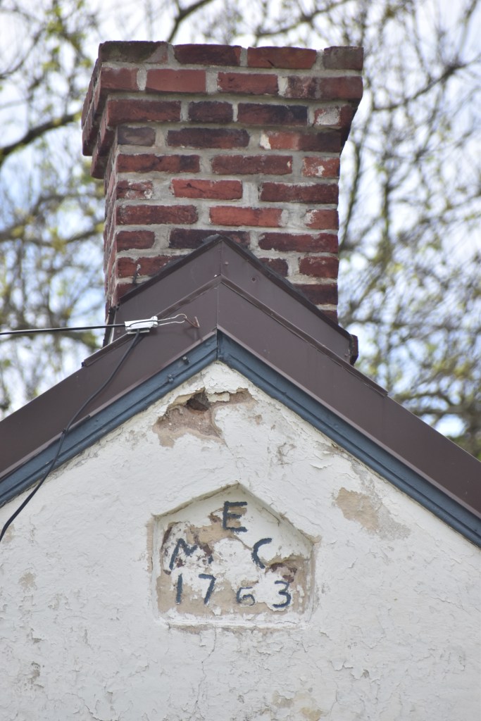
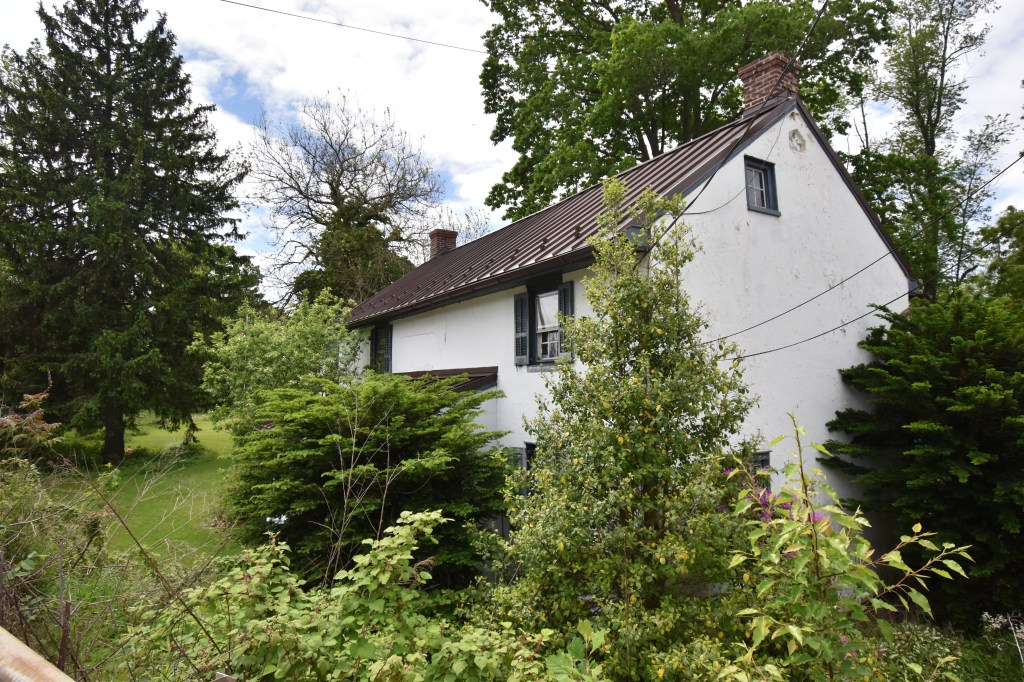
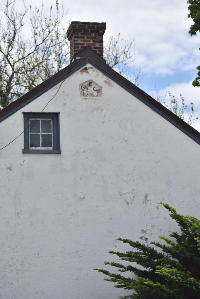
Situated on the road to Trappe just past the industrial park is the Mordechai Evans House, built in 1763 and one of the first homes in the area. It’s believed that Washington stopped here after fording the river and wrote a letter to Congress while drying his clothes at the hearth of this house.
The letter from George Washington to John Hancock, 19 September 1777, is as follows:
“ To John Hancock, Parkers Ford—on Schuylkill [Pa.] Septr 19: 1777 ¾ after 5. P.M.SirI was honoured this Morning with your Favors of the 17th & 18th, with their Inclosures. I am much obliged to Congress for the late instance of their Confidence, expressed in their Resolution of the 17th, and shall be happy if my conduct in discharging the Objects, they had in view should be such as to meet their approbation.I am now repassing the Schuylkill at Parkers Ford, with the Main body of the Army, which I hope will be over in an hour or Two though the water is deep & rapid. Genl Wayne with the Division under his command is in the Rear of the Enemy, and will be joined to Morrow or next day, I expect, by Genl Smallwood and Colo. Gist with their Corps. As soon as the Troops have crossed the River, I shall march them as expeditiously as possible towards Fat Land—Sweds & the Other Fords, where it is most probable the Enemy will attempt to pass.” (“From George Washington to John Hancock, 19 September 1777,” Founders Online, National Archives, https://founders.archives.gov/documents/Washington/03-11-02-0268. [Original source: The Papers of George Washington, Revolutionary War Series, vol. 11, 19 August 1777 – 25 October 1777, ed. Philander D. Chase and Edward G. Lengel. Charlottesville: University Press of Virginia, 2001, pp. 268–270.])
It appears that he wrote this letter at 5:45 PM on the 19th after crossing the river while he waited for the rest of the army to cross. Therefore, it’s likely he didn’t stay at the Parker Tavern the night of the 19th but proceeded with the army on a night march to the lower fords.The letter was simply an updated report to Congress on Washington’s current situation. You can read the entire letter here: https://founders.archives.gov/documents/Washington/03-11-02-0268
Regarding the crossing for the army and subsequent march, “Gen. Peter Muhlenberg’s father, Henry Melchior Muhlenberg (1711–1787), a renowned Lutheran clergyman who lived at Trappe, wrote in his journal entry for this date that he “received news in the afternoon that the British troops had marched across toward Providence on the other side of and farther down the Schulkiel. Their camp could be seen, I was told, through a fieldglass. The American troops then marched through the Schulkiel, four miles from us, and came out on the road to Philadelphia at Augustus Church [the Great Road I mentioned above]. They had to wade through the river up to their chests. His Excellency General W[ashington] was himself with the troops who marched past here to the Perkiome. The passage of the troops lasted through the night and we had all kinds of visitors, officers, etc. To get wet up to one’s chest and then to march in the cold, foggy night while enduring hunger and thirst, etc. is hard for the poor men. It takes courage, health, etc. But instead of prayers, what one hears from many of them is the horrible national vice: cursing” (Tappert and Doberstein, Muhlenberg Journals, 3:77–78).”
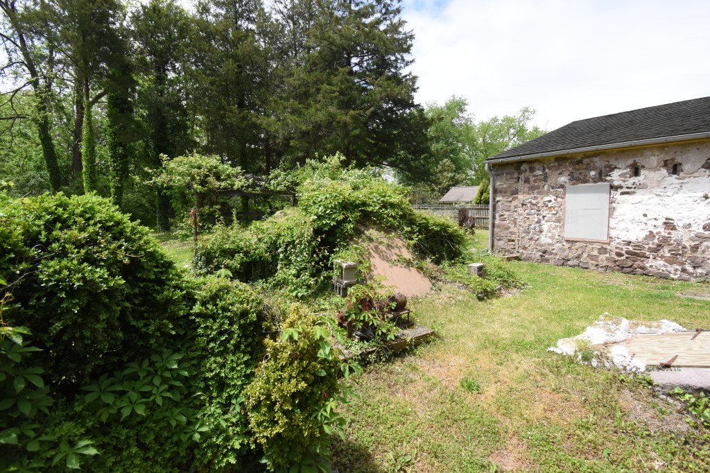
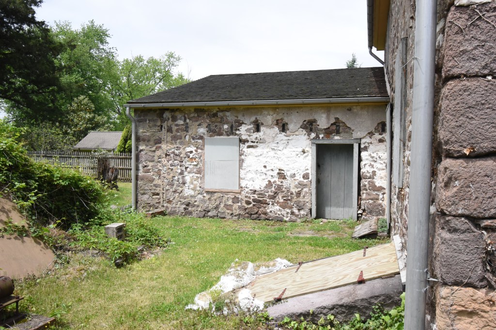
Pictured is the Evans House where Washington stopped. The original home was built around 1720, one half mile from the ford and was a simple log cabin. Additions and outbuildings were added with the main addition completed in 1763, and this was the condition at the time of Washington’s visit. South of the house, towards the river was another Evans home which was there during the Revolution. In front of the house was a small outbuilding that served as a post office, and mail was dispatched by boat back and forth with Philadelphia. Muriel Lichtenwalner maintains that Washington’s letter was dispatched from here and made its way to Hancock and Congress. (“Limerick Township: A Journey Through Time 1699 – 1987” by Muriel E. Lichtenwalner, Limerick Township Historical Society, Limerick, PA 1987)
There were several other buildings and mills in this area but they no longer exist and the area is overgrown, except for sections of the State Game Lands that are farmed. One can picture a quiet country road with the occasionally traveler passing by foot, on horseback or wagon, but “The lane to the river with its double row of trees can no longer be distinguished, for bushes and weeds have completely overgrown the area.” Muriel E. Lichtenwalner, “Limerick Township: A Journey…)Also see notes included with the photos.
After the Battle of the Clouds and the subsequent moves through Yellow Springs to Warwick and Reading Furnaces (more about the furnaces in a future post) Washington decided to move back East towards the British with the intention of crossing the Schuylkill River and defending the multiple fords against a British crossing. The British Army remained in the Tredyffrin and Valley Forge areas on the west side of the river and could cross at several locations to then move southeast into Philadelphia. The most direct route from the French Creek Valley area to the Providences opposite Fatland Ford, Swede’s Ford and others was Parker’s Ford located in East Vincent Township, Chester County. Parker’s Ford was named after Edward Parker who built a tavern there in 1766. Washington ordered Anthony Wayne’s troops to move from Warwick and take a position just west of the British Army to cover his rear. On September 19th, 1777, the rest of the Continental Army marched from Warwick Furnace to Parker’s Ford, about ten miles.
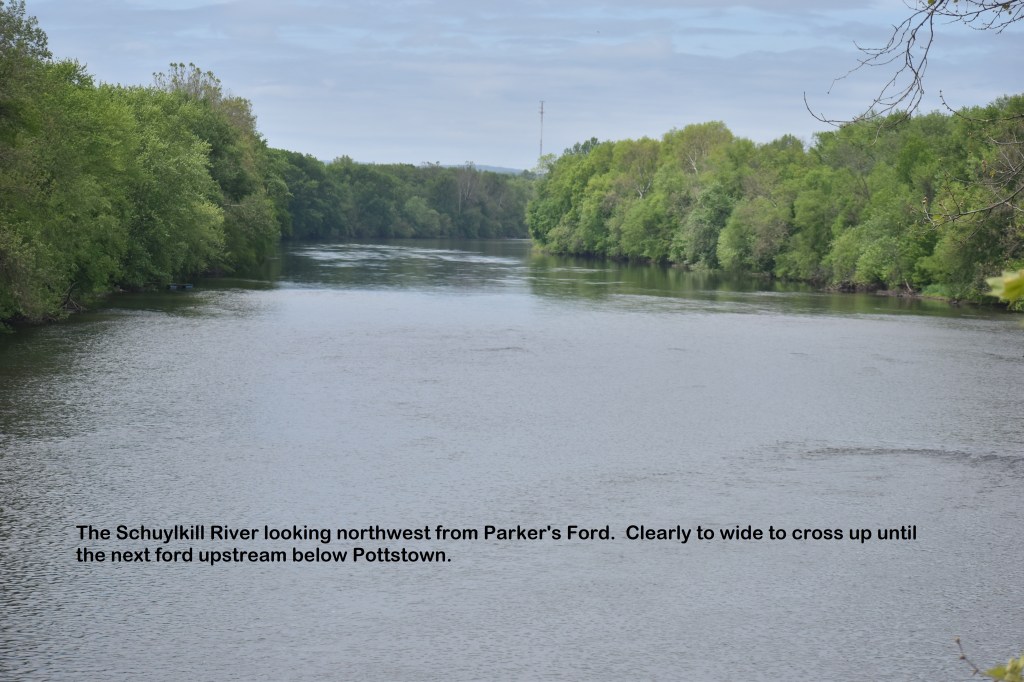
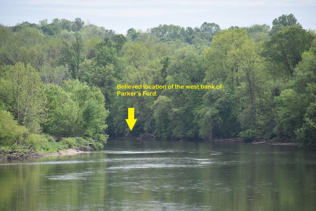
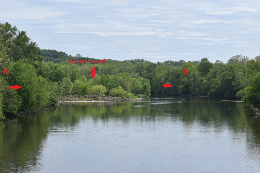
At the time, the town around Parker’s Tavern was known as Lawrenceville, and consisted of the tavern, several homes, a barn, outbuildings, and mills. It sat along the Schuylkill Road, or “Great Road” a main highway between Philadelphia and Reading. The Tavern is located approximately 175 yards from the banks of the river. It’s unknown exactly where the ford was located, however 19th century maps place it south of Pigeon Creek at a point where the river is split into two by what was known as a “five acre island.”
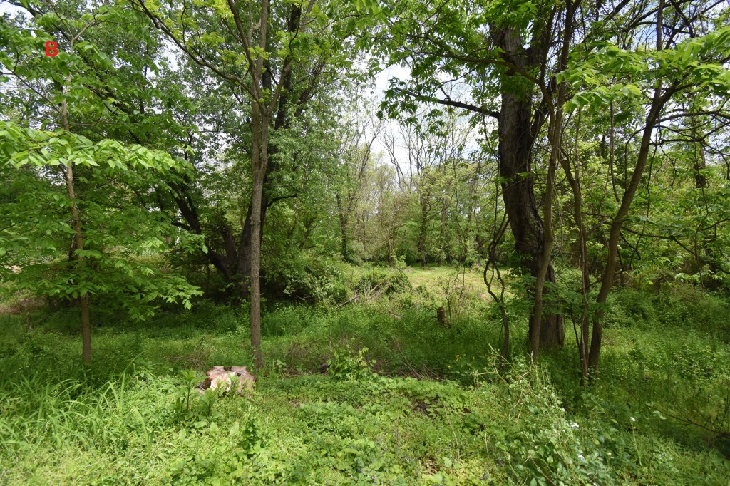
The location of the east side of the ford
Looking towards the river from the west side
The Schuylkill River north of the Linfield bridge
Location of west bank of the ford
View of the ford area from the bridge
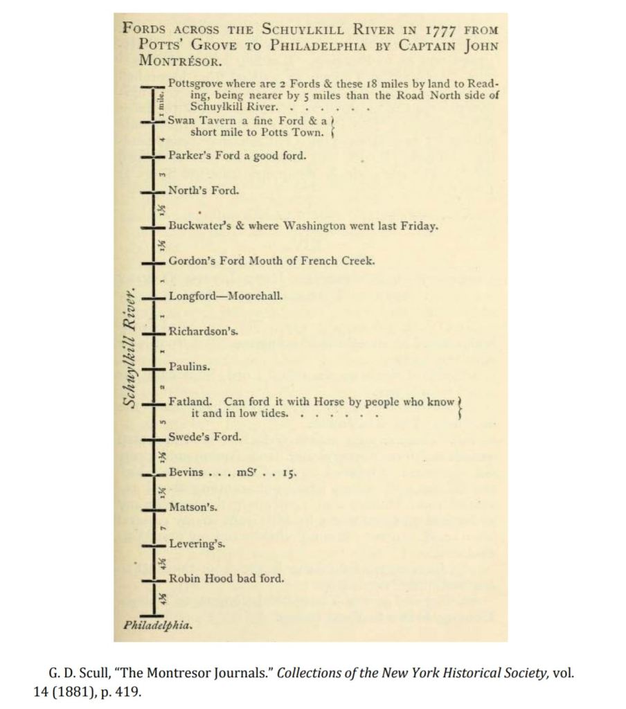
List of fords compiled by British
The area on both sides of the river now is completely overgrown with woods and heavy underbrush. There’s not trace of the road leading up to where the ford would be, on either side. On the east side, “This was Linfield-Trappe Road, which originated then at the ford, crossing the river to Limerick Township. The road across the river was submerged in 1848 as a result of the building of the Yankee Dam.” (“Limerick Township: A Journey Through Time 1699 – 1987” by Muriel E. Lichtenwalner, Limerick Township Historical Society, Limerick, PA 1987) The dam was removed in 2009, I imagine returning the water level to what it was at the time of the Continental Army’s crossing.
The army started arriving at the ford in the early afternoon on Friday the 19th and then proceeded to cross. Lt. James McMichael wrote in his diary: “At dawn, broke camp and crossed the Schuylkill at 2 P.M., at Parker’s Ford, where we had to strip to wade. Reached the great road to Reading, passed the Trappe, crossed the Perkiomen, on the eastern bank of which we encamped. Through false alarms we got no rest, tho’ after such fatigue rest would have been very agreeable” (William P. McMichael. “Diary of Lieutenant James McMichael, of the Pennsylvania Line, 1776–1778.” Pennsylvania Magazine of History and Biography 16 (1892)) .
“The story is told by the folks living the Parker’s Ford at that time is that the weary soldiers took off their clothing, wrapped it around their guns and crossed the river hodling guns and clothing over their heads. They had a long march ahead of them and preferred to do it in dry clothing.” (“Limerick Township: A Journey Through Time 1699 – 1987” by Muriel E. Lichtenwalner, Limerick Township Historical Society, Limerick, PA 1987)
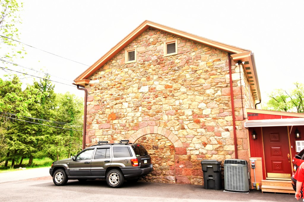
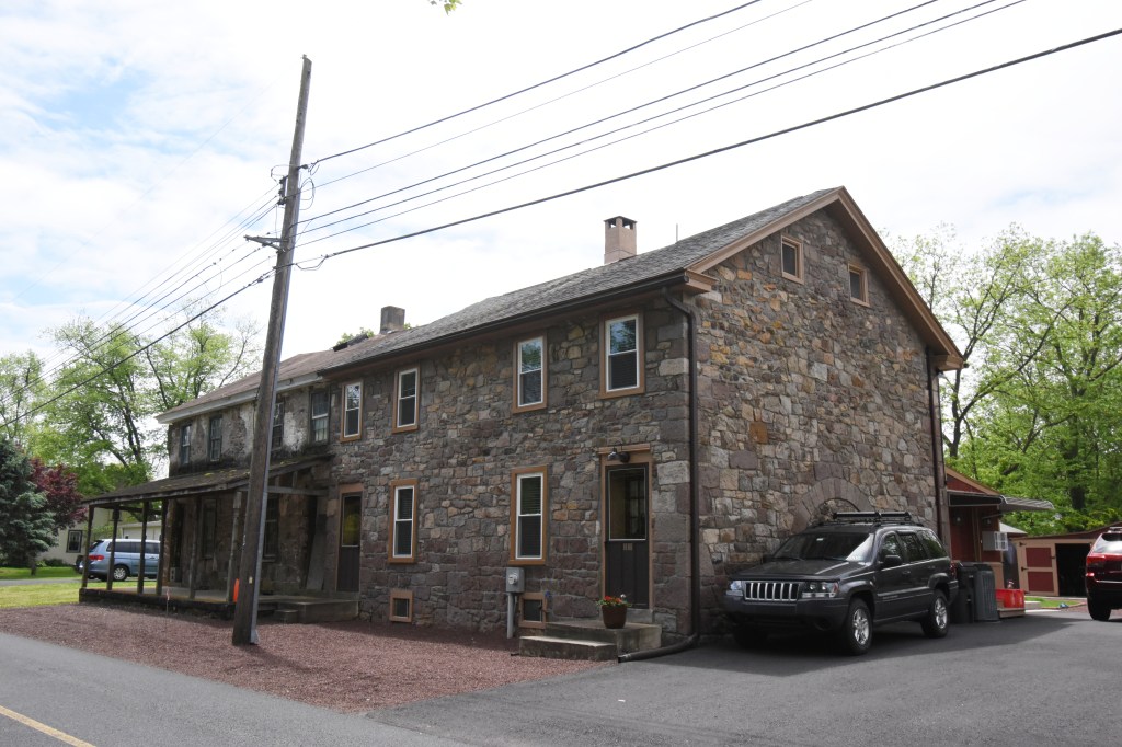
The stable and attached building
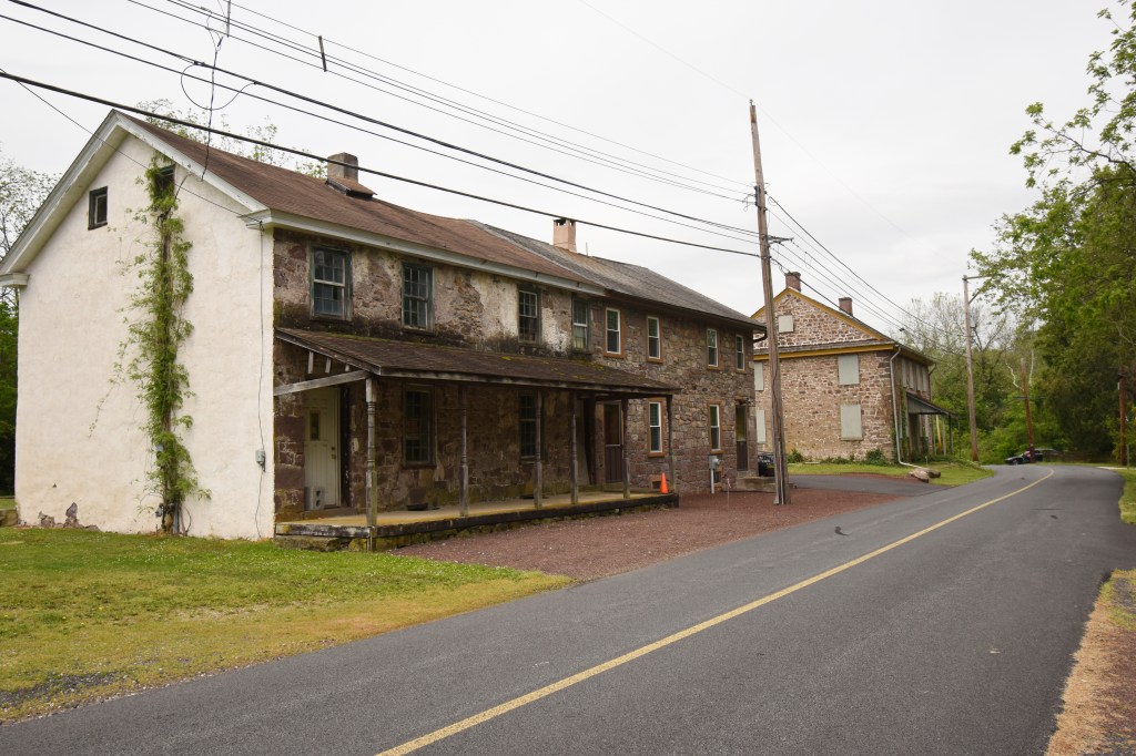
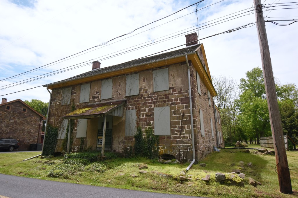
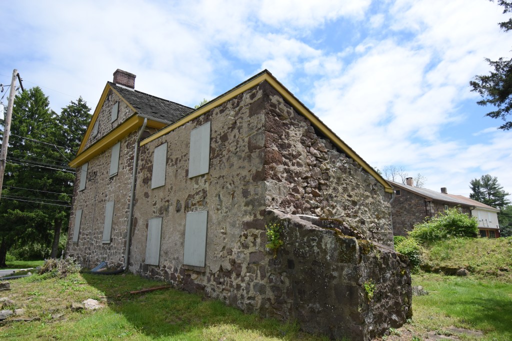
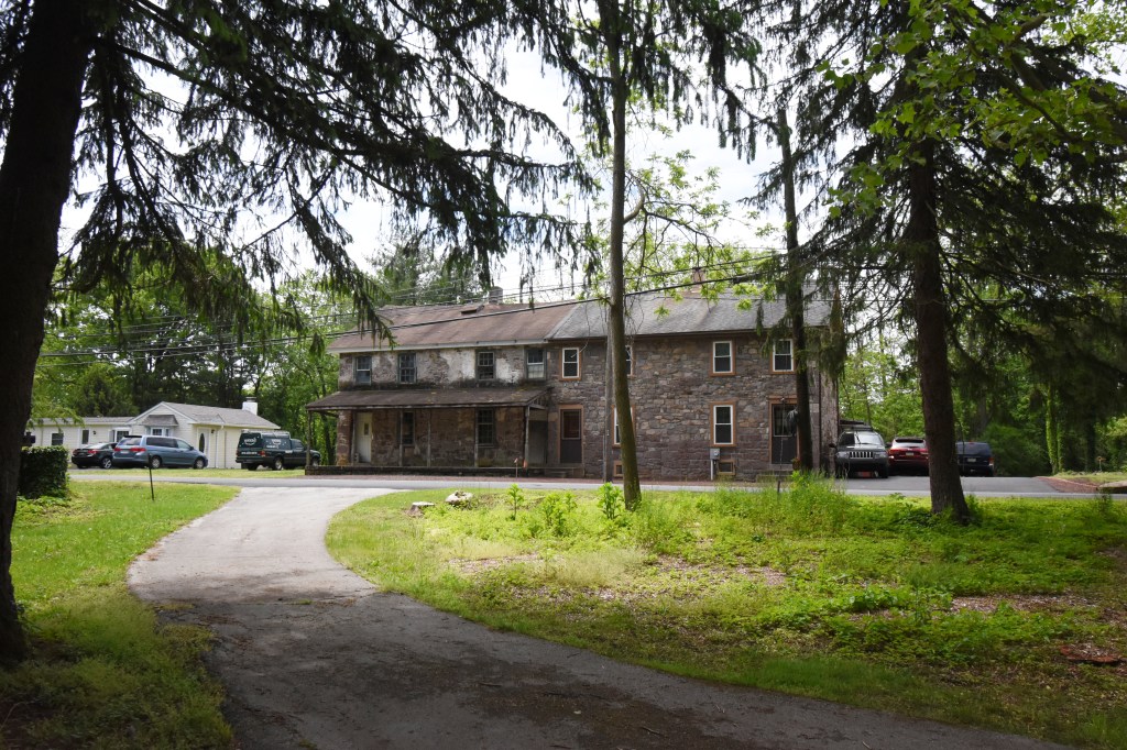
Parker’s Tavern
Side view of the stable, now a residence
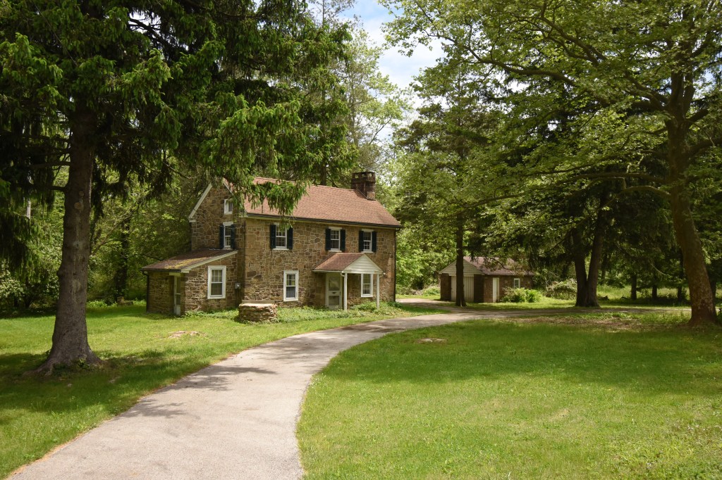
The main house at Parker’s Ford
Parker’s Tavern
Looking past Parker’s Tavern to the barn
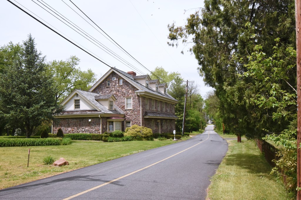
This house was not there at the time of the crossing, it was built by Parker’s son in 1803
Side and rear of the tavern
Rear of the tavern
The rear of the spring house
The Schuylkill Road looking Northwest
Detail from the Parker house
Side view of the tavern
Detail from front of tavern
Detail from front of tavern
The barn
Southeast side view of the tavern
The spring house in rear of tavern
Detail from rear of tavern
Spring house at rear of tavern
Barn from across the road
Tavern and house from across the road
It is believed that Washington spent the night of the 19th the Parker Tavern, however this may not be accurate (more about that in Part 2). Anthony Wayne’s troops were supposed to have crossed here after the Paoli Massacre several days later, probably around the 21st, to meet up with the rest of the army now moving on the east side of the river. (I haven’t done much research into Wayne’s movements after Paoli at the moment.)
Today, East Vincent Township owns the property, purchased in 2003, and there are plans for restoration, however nothing substantial has been done to the tavern building itself as far as I can tell (besides the roof and cornice). This is a beautiful area; the Schuylkill River Trail runs between here and Rt. 724 just to the west. I’d love to see a completely restored site with museum, interpretive displays, etc.